Project Description
In recent years, a lot of effort has been put into the field of Aerial Robotics by the research community as well as the industry, displaying a sharp acceleration. This effort has immediately started to bear fruit which is evident from the wide range of new applications that Unmanned Aerial Vehicles (UAVs) are involved in. At the same time, the integration of new technologies has contributed towards this direction as well. This technological growth happens to coincide with the global trend in miniaturization of many electronic devices which are used by professionals and amateurs in many applications of everyday life.
On the other hand, some studies [1] mention that these two events are highly correlated in the sense that the reduced size and weight of new actuators, embedded flight controllers, communication components as well as sensors (such as cameras, distance sensors, accelerometers, etc.) facilitate their hosting by small aerial robots. As a result, nowadays UAVs are used to reach inaccessible locations with the main focus on collecting any kind of useful information. Concretely, some of the most common commercial applications are forest surveillance and fire detection, coastal zone surveillance and marine rescue, detection of watershed pollution, mining, agriculture and payload carrying. In addition, the low cost and the safety ensured by the embedded controllers and the lightweight structure provide accessibility to the UAV market even for hobbyists and amateurs who are mostly interested in aerial photography and videography.
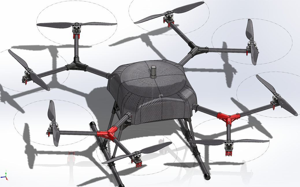
Figure 1: UAV designed in the frames of the CALLISTO project by ACCELIGENCE Ltd.
Another category of applications that gains increasing attention and is more related to the objectives of the CALLISTO project focuses on the exploitation of the visual, spatial, and temporal information provided by the UAV in order to complement or even enhance the earth observation (EO) data received by the satellite constellations. According to [1], there are some pros and cons regarding the quality and quantity of information that can be acquired in each case. To start with, satellite images mostly capture changes taking place in large areas over time, but with low resolution.
In contrast, UAVs usually perform flights with no authorization permission requirement at a location defined by the user who has access in the derived information directly, while the EO images obtained during a UAV operation are mostly characterized by high spatial resolution. This comes at the cost of covering relatively small areas due to the low altitude that is permitted to fly and the limited battery capacity. Another factor that might make one option more preferable than the other is the weather conditions in the area of interest at the moment the data are requested. For example, clouds prevent satellites from having visual contact with the earth’s surface, while a low altitude UAV flight can overcome this issue. On the other hand, a UAV might not be able to perform flights during windy weather conditions. It is evident that there is a trade-off between the two approaches, and the dominant one is defined after taking into consideration the requirements that have been set for the specific application. However, over the last decade, research on some methods that attempt to fuse data obtained from both sources, thus enriching the total information, shows some promising results towards the exploitation of the advantages of both approaches.
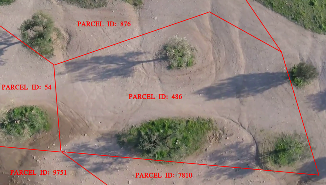
Figure 2: Crop monitoring performed by ACCELIGENCE’s UAV
Eventually, focusing more on the CALLISTO project, the application where the UAV shown in Fig.[1] gets involved in lies in the wide area of crop monitoring (Fig.[2]). There, before the integration of UAVs, the relevant tasks were performed either manually by inspectors or after analyzing satellite images. The disadvantages of both solutions are apparent. As regards the manual inspection, it constitutes an exhausting and time-consuming process that requires automation to speed up the necessary bureaucratic procedures. Although the analysis of satellite images contributed towards this direction by solving a non-negligible part of the aforementioned issues, still there is generally room for improvement, in terms of the resolution of the acquired data. As already stated, the main advantage of the UAV usage is the higher resolution of images compared to the satellite ones. This feature along with the efficient scanning of the requested parcel(s) through a path planning algorithm are planned to be exploited within CALLISTO, aiming at the enhancement of the crop monitoring application in the context of the 1st Pilot Use Case: CAP monitoring.
[1] Emilien, A.V., Thomas, C. and Thomas, H., 2021. UAV & satellite synergies for optical remote sensing applications: A literature review. Science of Remote Sensing, 3, p.100019.
Project Details
- DateFebruary 24, 2022
- WriterParis Oikonomou, Senior Electrical Engineer at ACCELIGENCE Ltd.
- 1
