Project Description
On the 19th April 2022 it was a sunny day in the North of Italy; it was a perfect day to perform the first water quality monitoring campaign over the lagoon basins, foreseen in the CALLISTO project. The focus of this monitoring campaign was quite different from what is usually performed from an integrated water service manager: this time, we were not only looking downward, in order to grab the sample and perform in-situ water quality analysis, but also upward, toward the sky, because in that precise moment two different satellites were watching us.
But let’s start from the beginning.
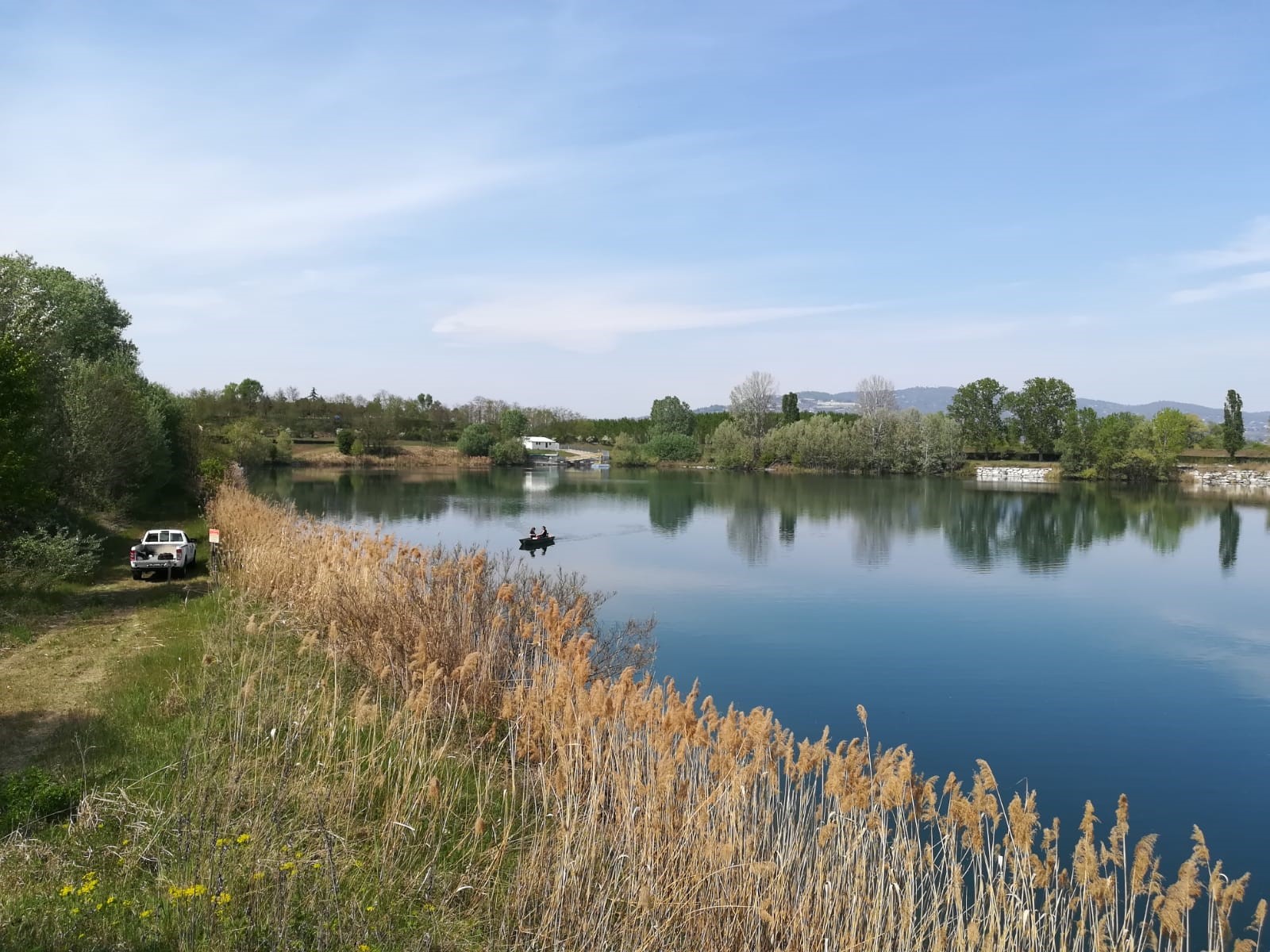
Figure 1 – Water quality monitoring campaign over the lagoon basins performed with a small boat.
Since the ’60s, the city of Turin has been using surface water from river Po in order to supply water to its inhabitants: on one hand, this represents an invaluable resource to meet the demand of a growing population; on the other hand it helps in coping with the spread of pollution in underground aquifers. Between the ‘80s and ‘90s, following a monitoring programme of the Po river, it was hypothesized to relocate the river intake upstream of the existing one, in order to avoid the polluting load deriving from the residential settlements located upstream of the intake structure. In that framework, it was decided to exploit a disused quarry lake to operate a water pre-treatment through a “lagooning process”.
The “lagooning process” refers to deriving water from a canal (in this case an artificial canal that derives water from the Po river and leads it to the thermoelectric plant) and accumulating it in the basin for an adequate time, before taking it back to the drinking water treatment plants. The main advantages in using this process is that the sedimentation and natural purification processes reduce chemical and biological pollutants. At the same time, sudden variations in water quality are avoided (thus allowing an optimisation of the treatment process with less chemical reagents), and the lagoon basin can be used in case of heavy river pollution or of drought events. On the other hand, the main disadvantage of the “lagooning process” is linked to the possible proliferation of algae, that could impact both the plant operation and water safety for human health.
Therefore, water quality of the basin must be carefully monitored.
Since the basin was put into operation, in 2007, it was subjected to a regular monitoring; at the beginning samples were taken and analysed into our laboratory. Then, thanks to the technological evolution, it was possible to acquire and analyse data continuously, thus providing a real-time monitoring of the water that enters the treatment plant. Nowadays, the ever-increasing availability of satellite data acquired by various space missions, often made available to users in an open way for free, combined with the growing ability to transform these data into information, makes it possible to obtain new type of information useful for water quality monitoring.
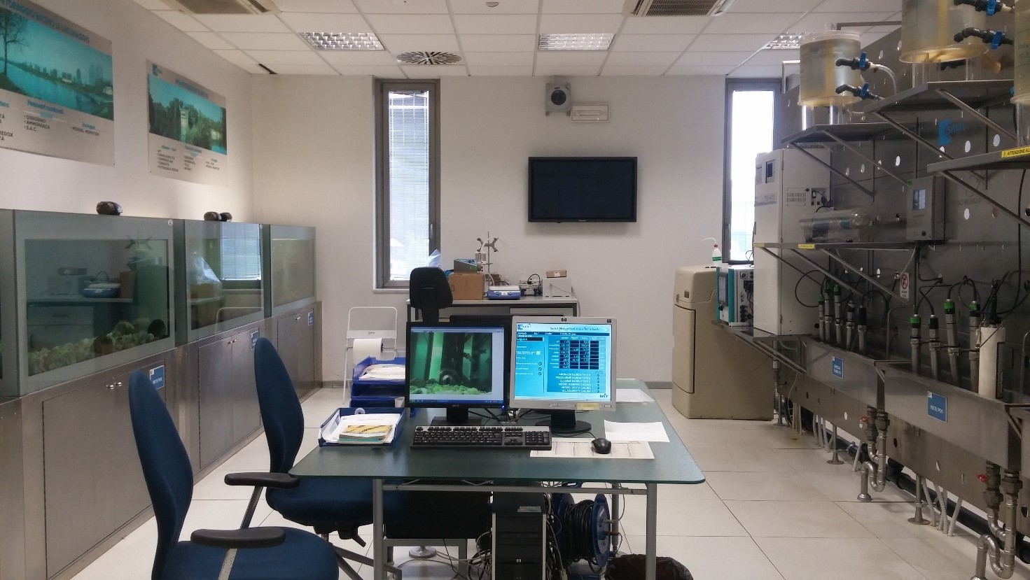
Figure 2 – On-line monitoring station that provides real time water quality monitoring.
In the CALLISTO project, SMAT provides in-situ data that will be used for the validation of algorithms that elaborate satellite (Sentinel-2 and Landsat-8) images to extract water quality information.
The first monitoring campaign successfully started with the acquisition of 15 samples on the surface of the basin and other 10 samples below the surface, in order to evaluate water quality variation (and, specifically, algae growth) in all the basin volume (Figure 3). In the collected samples we will analyse:
- parameters that will also be derived from satellite images using dedicated algorithms (Chlorophyll, turbidity, temperature);
- parameters related to the algal growth phenomenon (pH, dissolved oxygen, phosphates, nitrates)
An important parameter to be acquired during the monitoring campaign is transparency, which is measured with a Secchi disk (Figure 4). This measure is essential to estimate the maximum depth that can actually be seen by the satellite.
Other monitoring campaigns are planned in May, June, and July, in order to acquire data in different condition (both with and without algae bloom in place).
Once the algorithm is validated, the output will be used to integrate and extend the real-time monitoring system in-place. Currently, we monitor the lagoon outlet; satellite-derived water quality information will enable us to look at the whole basin surface at a glance.
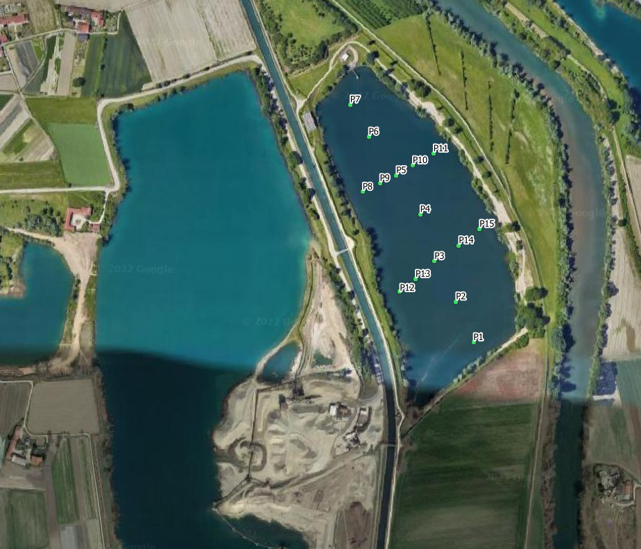
Figure 3 – Sample points of the monitoring campaign performed by SMAT in order to acquire data for satellite water quality products validation.
![]()
Figure 4 – Secchi disk used to measure water transparency in water bodies.
Project Details
- DateApril 29, 2022
- WriterSara Steffenino and Beatrice Coloru, SMAT
- 4
